 DroneScout
Detect your first drone
Last reviewed: 2026-10-10
DroneScout shows every drone near you that broadcasts Remote ID, live on a map. This guide walks you through the basics; everything here is in the free version.
1. Allow Bluetooth and Location
When you first open DroneScout, it asks for two permissions:
- Bluetooth (on Android: Nearby devices), to receive the drones' broadcasts;
- Location, which Android and iOS require for any app that scans for Bluetooth devices. It also lets DroneScout show your own position and your distance to each drone. DroneScout doesn't send your location anywhere.
On Android, consider switching on Wi-Fi scanning in the app's settings too: most drones, and all DJI drones, broadcast over Wi-Fi. See See more drones on Android.
2. Find drones on the map
Each drone that broadcasts appears on the map as a blue icon, usually within a second or two of coming into range:
- The icon's shape shows the kind of aircraft the drone says it is — a multicopter, a fixed-wing plane, a helicopter, a balloon and so on.
- The icon points the way the drone is flying. A drone that doesn't broadcast a direction, for example while it hovers, gets a slightly different icon.
- The bar at the bottom shows how many drones are around. Swipe it up for the drone list: every drone currently detected, with its ID, its height, the radio signal it arrived on and how long ago it was last seen.
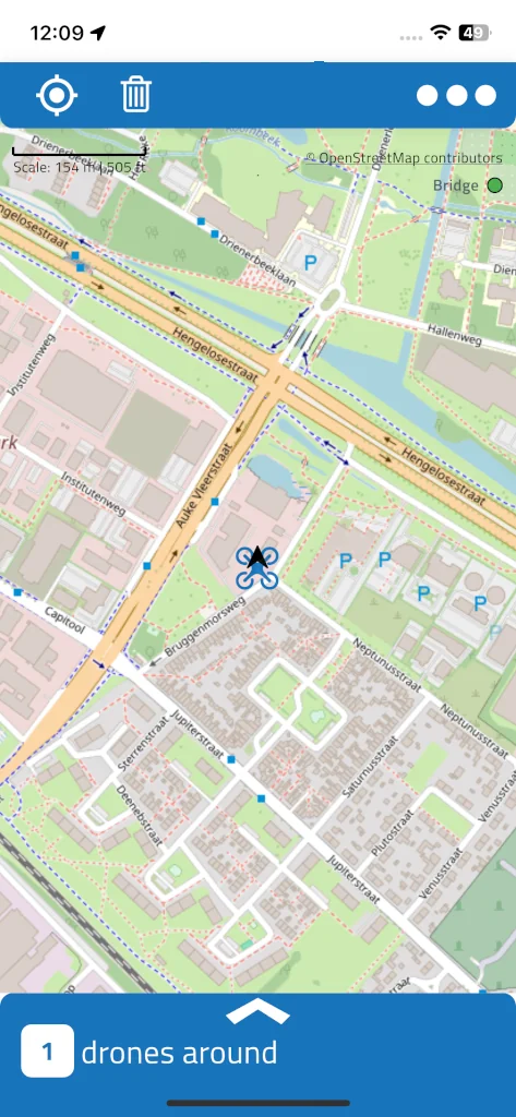
Nothing on the map? There may simply be no broadcasting drone in the air nearby — DJI drones only start broadcasting once they're airborne. More reasons: Why am I not detecting nearby drones?
3. Tap a drone: track and pilot
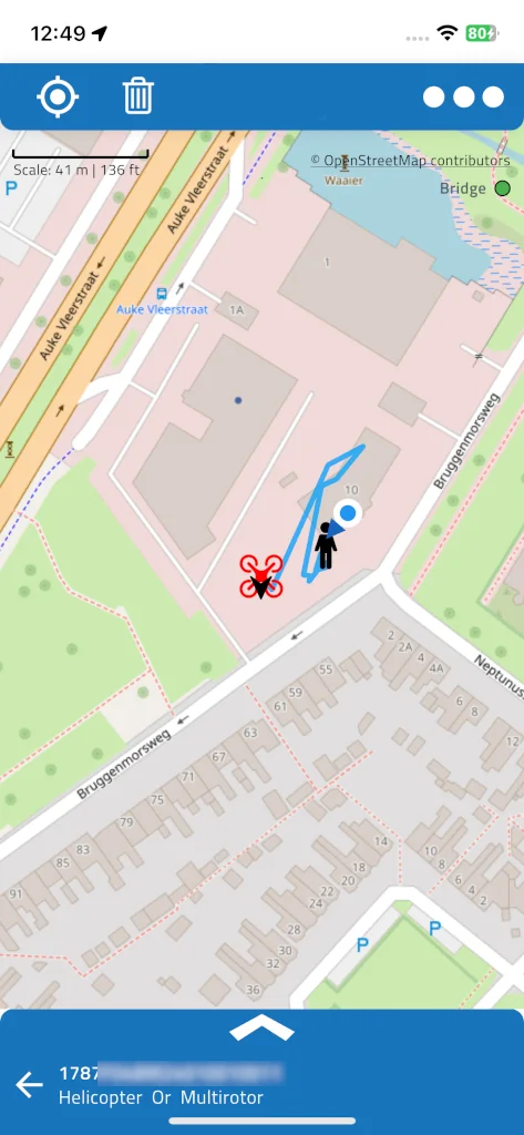
Tap a drone on the map, or in the drone list. Three things happen:
- The drone's icon turns red and the map centres on it.
- A light-blue line shows the track it has flown since DroneScout first saw it.
- A black pilot icon shows where the pilot stands, or where the drone took off — the broadcast says which. If the drone doesn't broadcast a pilot location at all, the pilot icon sits on top of the drone itself.
The blue dot is your own position. The bottom bar now shows the drone's ID and type; swipe it up to open the details.
4. Read the drone's details
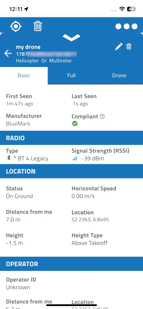
The blue header at the top shows the drone's ID — its serial number or registration — its type and, if you've given it one, your own label. The share icon in the header exports the track to a GPX file.
The Basic tab has the essentials:
- At the top: when the drone was first and last seen, its manufacturer (recognised from the serial number), and whether its broadcast is compliant — a green check, or a warning sign when a mandatory field is missing. Tap the ? for what that means.
- Radio: the radio type it arrived on — Bluetooth Legacy, Bluetooth Long Range, Wi-Fi Beacon or Wi-Fi NaN — and the signal strength (RSSI).
- Location: whether the drone is airborne or on the ground, its height and what that height is measured from, its speed, and its distance from you.
- Operator: the operator ID — in the EU and the UK, the operator's registration number — and the drone's category and class, when it broadcasts them.
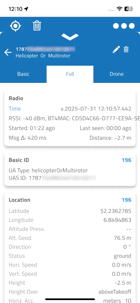
The Full tab shows every field of every message the drone sends — Basic ID, Location, Self ID, System, Operator ID and Auth — with a count of how many of each were received, the average time between messages (Msg Δ), and a button to export all raw messages to CSV. It's mostly of interest if you build or test drones: see Test your own drone's Remote ID.
With a Silver, Gold or Platinum subscription there's a third tab, Drone, with the drone's model, type, weight and dimensions.
To close the details and go back to the map, tap the back arrow in the header.
What to do next
- See more drones, and further away: Use DroneScout Bridge, a small receiver that works with iPhone and Android.
- Get a warning when a drone appears, also with the screen off: Keep scanning in the background.
- Give drones you see often a name: Label drones and add notes.
- Not sure why a drone shows up late or without a pilot location? Why some drones show up late or with missing details.
Troubleshooting
| Problem | What to check |
|---|---|
| No drones at all | Bluetooth and Location are allowed and switched on; on Android, Wi-Fi scanning is on in the app's settings; a broadcasting drone is actually in the air nearby |
| A drone appears only now and then | On Android, Wi-Fi drones (like DJI) update only about twice a minute — see See more drones on Android |
| No DJI drones on an iPhone | iPhones can't receive Wi-Fi Remote ID — see Remote ID on iPhone |
| The pilot icon is on top of the drone | The drone doesn't broadcast a pilot or take-off location |
| No Drone tab | It needs a Silver, Gold or Platinum subscription |